
🇮🇸 🇮🇸 🇮🇸
The Laugavegur and Fimmvörðuháls trek has been listed by National Geographic as one of the “World’s Best Hikes” due to the unique and extremely diverse landscape encountered on the trail. One can see everything from sizzling hot springs and volcanoes to icy white glaciers. We walked through geothermally active lands of colored rhyolite mountains, obsidian fields, cross glacier rivers, and so much more on our journey. We stay in rustic, but charming highland huts located in remote areas. Each area is unique, revealing new features in the ever-changing landscapes of the trail.
Day 1 Reykjavik to Landmannalaugar
We departed early in the morning from the center of Reykjavik to make the most of the day. I was picked up from my YHA hostel. The drive to Landmannalaugar took about 3-4 hours, first of all along the south coast, and then up into the highlands, where we spent the rest of the week. The journey was highly scenic and fascinating, taking us by the magnificent volcano mountain, Hekla, the most active volcano in Iceland (actually if your phone is hooked onto network you will get text warning you that you should be prepared to evacuate immediately if some volcanic activity is detected) . This volcano, said by many Europeans in the Middle Ages to be ‘The Gateway to Hell,’ has erupted every 10 – 15 years throughout the last century.
Landmannalaugar is the starting point for the Laugavegur trail. We made our way through the Laugahraun lava field and Vondugil canyon. We also admired the incredibly vibrant colors of the rhyolite mountains, most notably Mt. Brennisteinsalda. On the way back to our accommodation for our first night at Landmannalaugar, we saw the Graenagil gorge and climbed upto Bláhnjúkur Volcano.


Distance: 8 km (4.9 mi) Walking time: 4 hrs Ascent: 470 m (1540′).
Day 2 Landmannalaugar to Alftavatn
After a good sleep and a nutritious breakfast, we were energized and ready to hit the trail again! The pitch-black obsidian desert called Hrafntinnusker, vibrantly colored Reykjafjöll rhyolite mountains, and the Jökultungur area are at the top of the agenda today. Geothermal activity has turned these craggy gullies into burnt and sometimes vivid yellows and reds over time. These colors contrast dramatically with the soft pale sandy hues around them. The top of Jökultungur is a wonderful place to enjoy views over the whole Fjallabak (behind the mountain) area and Álftavatn lake, where we will be spending the night. We had to cross a river on foot to get to our hut accommodation. Wading a river is usually an extremely exciting experience for hikers.
Distance: 24 km (14.9 mi) Walking time: 7 hrs Ascent: 900 m (2952′)


Day 3 Alftavatn to Emstrur
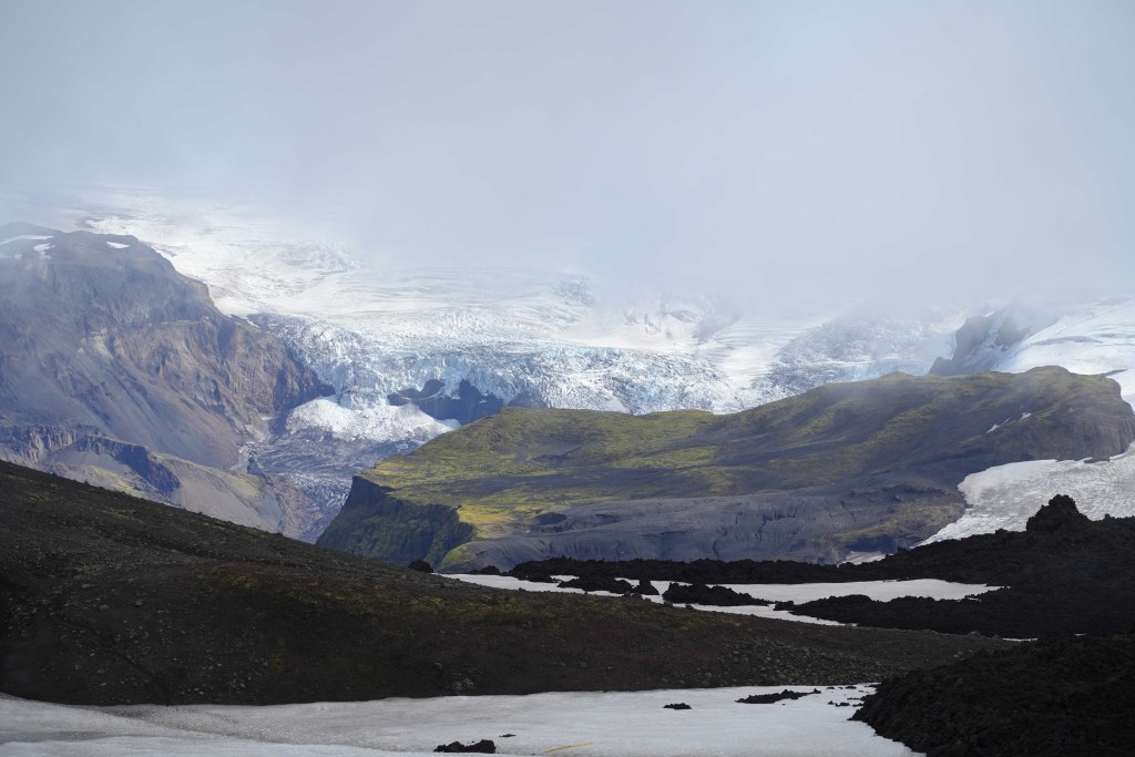
After an energizing breakfast, we are ready to set off again! We begin by wading across another stream as we proceed onto Mælifellssandur and into the volcano country. We will pass the Stórasúla and Hattafell volcanoes on our way to Emstrur, from where, in clear visibility, we will get outstanding views of the Eyjafjallajökull and Mýrdalsjökull volcano mountain glaciers. On our way to Botnar, a green oasis amid a black sand desert, we will see Markarfljótsgljúfur, a stunning 200 m deep canyon fashioned by a glacial river. We will spend the night in this area.
Distance: 15 km (9.5 mi) Walking time: 6-7 hrs Descent: 40 m (130′).


Day 4 Emstrur to Thorsmork Valley
After a good breakfast, we leave Emstrur and hike to Þórsmörk. As we go through the Almenningar gorge by Mount Einhyrningur (the Unicorn Mountain), we will still have a great view of the glaciers as we advance towards Þórsmörk. As we get closer to the landscape and nature change, a few trees appear here and there, setting the tone for the characteristic dense birch forest for which Þórsmörk is famous. Our accommodation will be in a simply magnificent location to spend a night, beneath the Eyjafjallajökull and Mýrdalsjökull glaciers. You can now celebrate your completion of the world-famous Laugavegur Trail!
Distance: 15 km (9.5 mi) Walking time: 6-7 hrs Descent: 300 m (985′).


Day Highlights
- Emstrur
- Mount Einhyrningur
- Þórsmörk Valley
- Glacier views
Day 5 Hiking to Magni and Modi Volcano ,Fimmvörðuháls Pass
Fimmvörðuháls is the magnificent high mountain pass between Mýrdalajökull and Eyjafjallajökull – the infamous volcano that erupted in 2010. Today, we visited the two new volcano craters, Magni and Móði, formed in the first eruption in 2010. Magni and Móði are named after the sons of Þór (Thor), the Norse God, their names meaning “strong” and “brave.”
The scenery on the Fimmvörðuháls Pass is fantastic and stunning. The new lava focuses on the way Iceland is still being formed by volcanic activity.
We spent a final night among the other-worldly vistas of Þórsmork. We celebrated the completion of the Laugavegur and Fimmvorðuháls trails with the traditional Icelandic way with a delicious grilled lamb dinner.
Distance: 16 km (10 mi) Walking time: 7-8 hrs Ascent: 800 m (2600′).


Day Highlights
- Fimmvörðuháls
- Famous volcano eruption site of 2010
- New craters Magni and Móði
- Traditional Icelandic lamb meal
Day 6 Thorsmork Valley to Reykjavik
We spent the last day exploring Þórsmörk and the surrounding area. We hiked up Mount Útigönguhöfði for an outstanding views over the valley and the glaciers. For those who are not up for a serious hike, a stroll to Húsadalur might be an option, or just relaxing around Langidalur before returning to Reykjavík. On our way to the city, you can glimpse Seljalandsfoss waterfall, one of the most popular tourist attractions in Iceland. We returned to Reykjavik in the early evening at around 18:30.
Distance: 6 km (3,5 mi) Walking time: 3 hrs.


